This map shows only what is documented: the firing range’s outline as mapped by OpenStreetMap contributors, the current airport, and named reference points. It draws no runway, terminal, rail or road alignment, because no official geometry has been published. The table below the map carries the same information and works without JavaScript or third-party requests.
- Documented location or boundary
- Proposed corridor (endpoints only)
- Approximate area / locality reference
No runway, terminal, railway or road alignment is drawn: no official geometry has been published. The firing-range outline is the military range as mapped by OpenStreetMap contributors, not the airport’s footprint. The Government places the airport at the range’s eastern end.
| Place | Accuracy | Description | Location | Source |
|---|---|---|---|---|
| Campo de Tiro de Alcochete (military firing range) | Documented location or boundary | Outline of the military firing range as mapped by OpenStreetMap contributors (relation 5366034). The legally selected site of the new airport lies within it; the Government's March 2026 response places the airport at the eastern end. This is not the airport footprint. | Boundary polygon | OpenStreetMap (ODbL), Nominatim lookup 18 Oct 2026, relation 5366034 |
| Humberto Delgado Airport (current Lisbon airport) | Documented location or boundary | The airport the new one is intended to replace completely (RCM 66/2024). | 38.7810° N, 9.1319° W | OpenStreetMap (ODbL), Nominatim lookup 18 Oct 2026, way 336112741 |
| Air Base No. 6, Montijo | Documented location or boundary | Site of the earlier, superseded Montijo complementary-airport proposal. Montijo is also listed as a municipality in APA process AIA 3982. | 38.7087° N, 9.0270° W | OpenStreetMap (ODbL), Nominatim lookup 18 Oct 2026, way 189769828 |
| Chelas (Lisbon) — proposed Third Tagus Crossing endpoint | Proposed corridor (endpoints only) | Named northern endpoint of the proposed Chelas–Barreiro/Lavradio crossing. No alignment is drawn because none has been published as approved geometry. | 38.7548° N, 9.1139° W | OpenStreetMap (ODbL), Nominatim lookup 18 Oct 2026, node 11304102294 |
| Lavradio (Barreiro) — proposed Third Tagus Crossing endpoint | Proposed corridor (endpoints only) | Named southern endpoint of the proposed crossing, per the July 2026 government announcement. | 38.6618° N, 9.0583° W | OpenStreetMap (ODbL), Nominatim lookup 18 Oct 2026, node 12009916740 |
| Central Lisbon (Praça do Comércio) | Approximate area / locality reference | Reference point for the claimed ~20-minute rail journey to central Lisbon. The exact city-centre terminus has not been specified in the sources reviewed. | 38.7077° N, 9.1365° W | OpenStreetMap (ODbL), Nominatim lookup 18 Oct 2026, way 677181958 |
| Benavente (municipality) | Approximate area / locality reference | Municipality in which most of the firing range lies. Marker shows the municipal reference point, not the airport. | 38.9827° N, 8.8096° W | OpenStreetMap (ODbL), Nominatim lookup 18 Oct 2026, relation 5400566 |
| Vendas Novas (historical alternative) | Approximate area / locality reference | Option examined by the Independent Technical Commission; the Government preferred Alcochete in May 2024, citing public land and proximity to Lisbon. | 38.6774° N, 8.4552° W | OpenStreetMap (ODbL), Nominatim lookup 18 Oct 2026, relation 5402587 |
| Alter do Chão (replacement firing range) | Approximate area / locality reference | Municipality announced in March 2026 for the replacement military firing range. Marker shows the municipal reference point only. | 39.2001° N, 7.6590° W | OpenStreetMap (ODbL), Nominatim lookup 18 Oct 2026, relation 5397419 |
Map data © OpenStreetMap contributors, available under the Open Database Licence (ODbL).
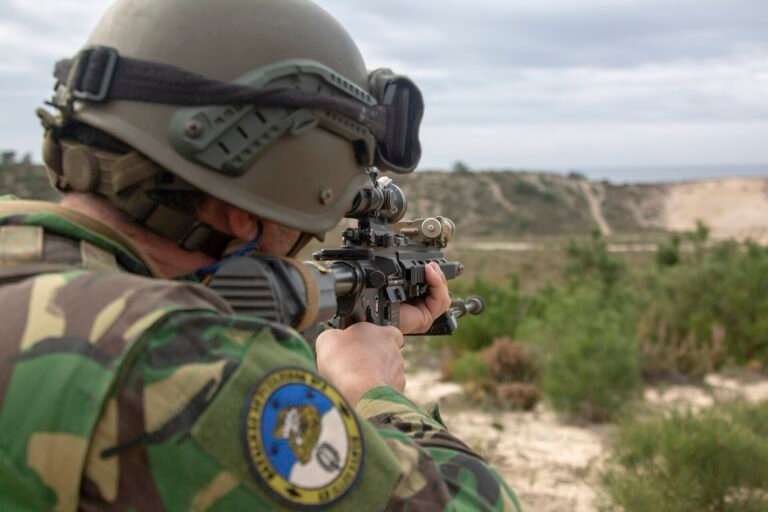
A Portuguese Marine during a bilateral exercise at the Campo de Tiro de Alcochete on 14 January 2020 — the site's current military use, which must end before construction. U.S. Marine Corps photo.
“Wild Crocodile II (6051342)”, author: U.S. Marine Corps photo by Cpl. Kenny Gomez, Public domain, via Wikimedia Commons. Resized to 1,600 px wide.
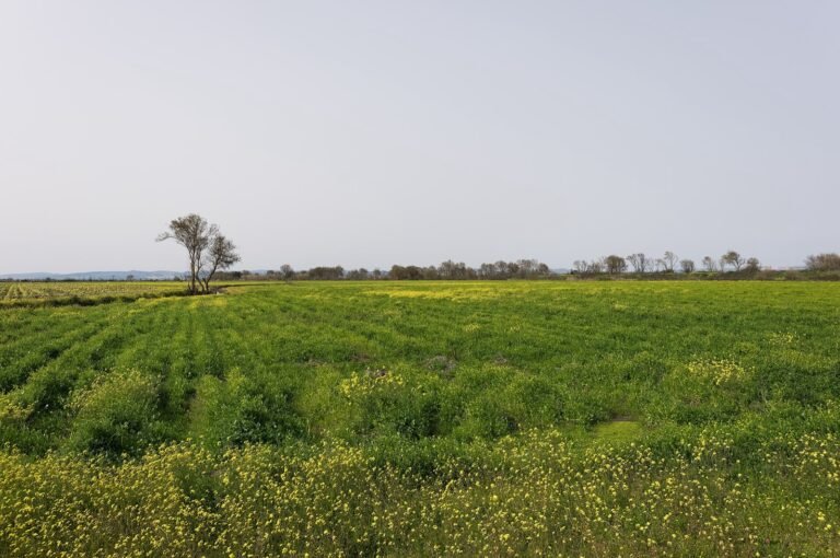
Flat farmland of the Tagus lezíria near Benavente, the municipality where most of the firing range — and the future airport — lies. February 2017.
“Lezíria fields near Benavente, Portugal (PPL1-Corrected) julesvernex2”, © Jules Verne Times Two, CC BY-SA 4.0, via Wikimedia Commons. Resized to 1,600 px wide.
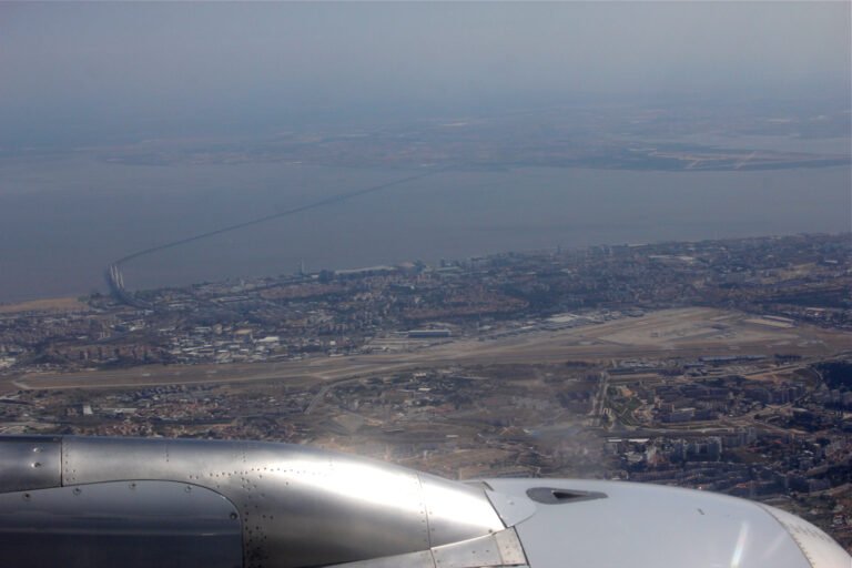
Lisbon's current airport, hemmed in by the city, with the Vasco da Gama Bridge crossing the Tagus estuary behind it. The new airport is planned east of the estuary, beyond the far shore. September 2013.
“Lisboa Airport LIS aerial view September 2013 with Ponte Vasco Da Gama”, © Wiki-observer, CC BY-SA 3.0, via Wikimedia Commons. Resized to 1,600 px wide.


The replacement firing range, to scale
What the documents say
- Status: Completed and verified Fact
In its response to ANA's selected-site and environmental report, the Ministry of Infrastructure and Housing agreed to placing the airport at the eastern end of the Campo de Tiro de Alcochete, the solution that received a conditional favourable environmental declaration in 2010.
Source: Portuguese Government (XXV Constitutional Government) Details and history: March 2026: location validated at the eastern end of the firing range
- Status: Legally decided Fact
Council of Ministers Resolution 30/2026 established preventive measures restricting land use in areas linked to the new airport.
Source: Diário da República Details and history: Preventive land-use measures adopted
- Status: Unverified Fact
The Government announced in May 2024 that it had decided to name the new airport after the poet Luís de Camões.
Source: Portuguese Government (XXIV Constitutional Government) Details and history: The airport is to be named after Luís de Camões
- Status: Legally decided Fact
Humberto Delgado Airport is to be kept, with increased capacity, only until the new airport is operational. The new airport is to become the region's only airport once fully built.
Source: Diário da República Source: Portuguese Government (XXIV Constitutional Government) Details and history: The new airport is to replace Humberto Delgado completely
- Status: Legally decided Fact
The Council of Ministers selected the Campo de Tiro de Alcochete, a military firing range mostly in the municipality of Benavente, as the site of the new Lisbon airport.
Source: Diário da República Source: Portuguese Government (XXIV Constitutional Government) Details and history: The new airport’s site is the Campo de Tiro de Alcochete
Questions answered
What is the Luís de Camões airport?
It is the planned new airport for Lisbon, to be built at the Campo de Tiro de Alcochete, a military firing range east of the Tagus estuary, mostly in the municipality of Benavente. It is intended to replace Humberto Delgado Airport completely.
Source: Diário da República Source: Portuguese Government (XXIV Constitutional Government) Permalink: What is the Luís de Camões airport?
Has the airport been approved?
The site has been chosen by law (RCM 66/2024). The airport itself has not been approved: the environmental assessment is open, the concession application is incomplete, and on 28 September 2026 the Government said its response to the technical report was not acceptance of the application.
Source: Diário da República Source: Agência Portuguesa do Ambiente (SIAIA) Source: Portuguese Government — Ministry of Infrastructure and Housing Permalink: Has the airport been approved?
Where exactly will it be built?
At the eastern end of the Campo de Tiro de Alcochete, according to the Government’s March 2026 validation. The precise footprint of runways and terminal has not been published, so the observatory’s map shows only the firing range’s outline and known reference points.
Source: Portuguese Government (XXV Constitutional Government) Source: OpenStreetMap contributors Permalink: Where exactly will it be built?
Which municipalities are involved?
APA’s environmental register for process AIA 3982 lists Benavente and Montijo. Road and rail links will affect other municipalities on both banks of the Tagus.
Source: Agência Portuguesa do Ambiente (SIAIA) Source: Portuguese Government (XXV Constitutional Government) Permalink: Which municipalities are involved?
Why is it called Luís de Camões?
The Government announced in May 2024 that it had decided to name the airport after Luís de Camões, Portugal’s national poet. The observatory has not yet confirmed whether the name is fixed in a legal instrument.
Source: Portuguese Government (XXIV Constitutional Government) Permalink: Why is it called Luís de Camões?
Where will the military firing range move?
To Alter do Chão, announced by the Ministry of National Defence in March 2026, for a new range of about 7,500 hectares with the municipal council’s support.
Source: Ministério da Defesa Nacional Permalink: Where will the military firing range move?
Sources
Location of the new airport validated at the Campo de Tiro de Alcochete
Original: Location of the new airport validated at the Campo de Tiro de Alcochete Link checked
Council of Ministers Resolution 30/2026 (preventive measures) RCM 30/2026
Original: Council of Ministers Resolution 30/2026 (preventive measures) Link checked
Government chooses Alcochete as the site of the new airport
Original: Government chooses Alcochete as the site of the new airport Link checked
Council of Ministers Resolution 66/2024 RCM 66/2024
Original: Council of Ministers Resolution 66/2024 Link checked